Services
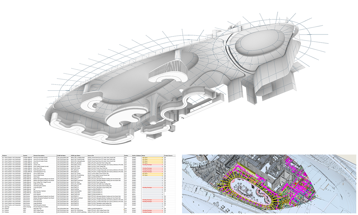
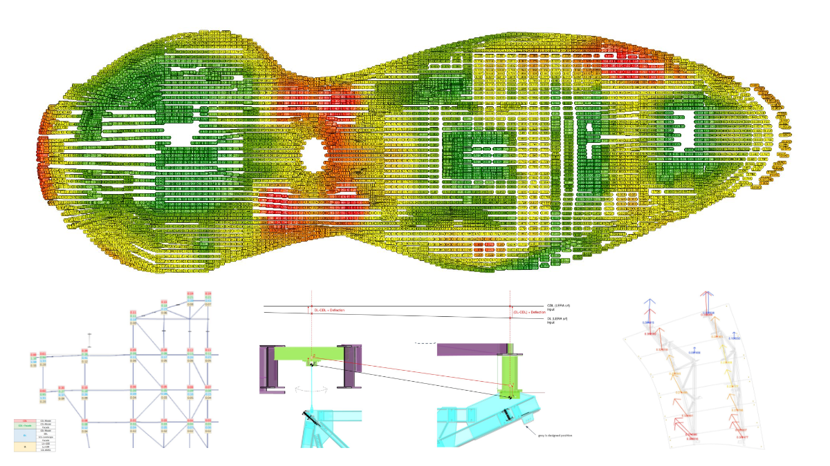
Model Management Framework
Model as Contract, Control Geometry, BIM Integration Management, Dimensional Control, Change Tracking, Dimensional Fidelity Analysis
3D Modeling
Automation Design, 3D Parametric Design, Analysis, LOD Models, Fabrication Models, BIM Coordination, Clash Detection, Model Review.
Design Assist
Constructability Review, Geometry Rationalization, Material Optimization, Labor Optimization, Prefabrication Strategy, Automation, Sequencing
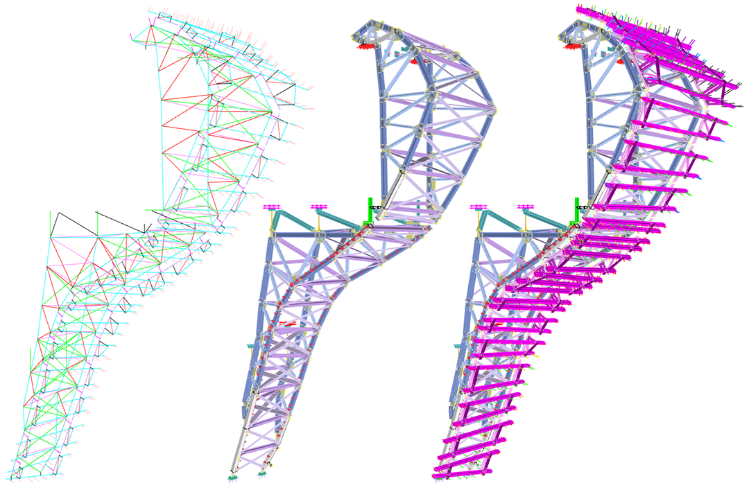
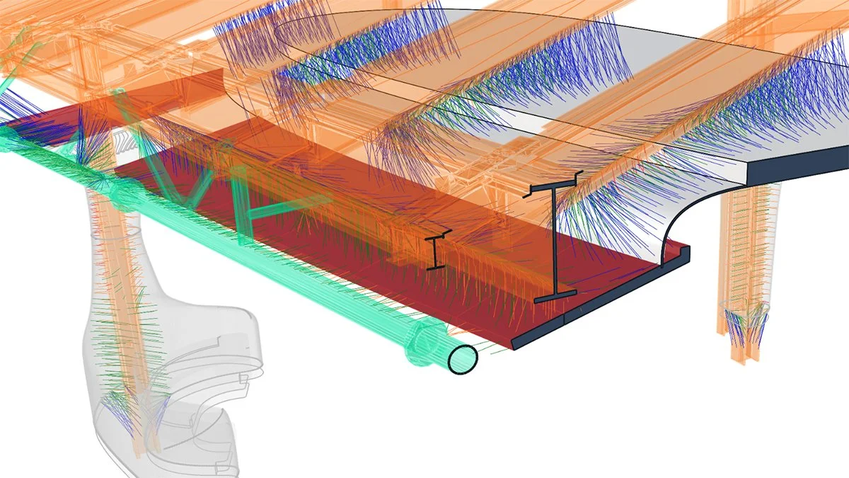
Engineering
Structural Engineering, Facade Engineering, Analysis Model Interoperability, 3D Simulations, Forensic Analysis, Centerline Generation, Optimization

Reality Capture
360° High Definition Photography, Drone Footage, Photogrammetry, Gaussian Splats, Point Clouds, Design-Grade Models
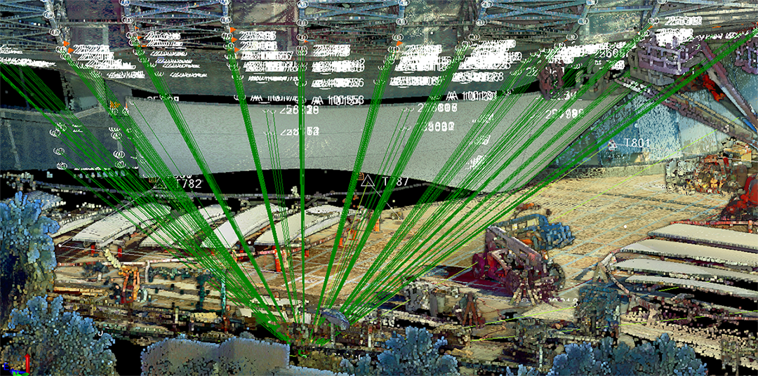
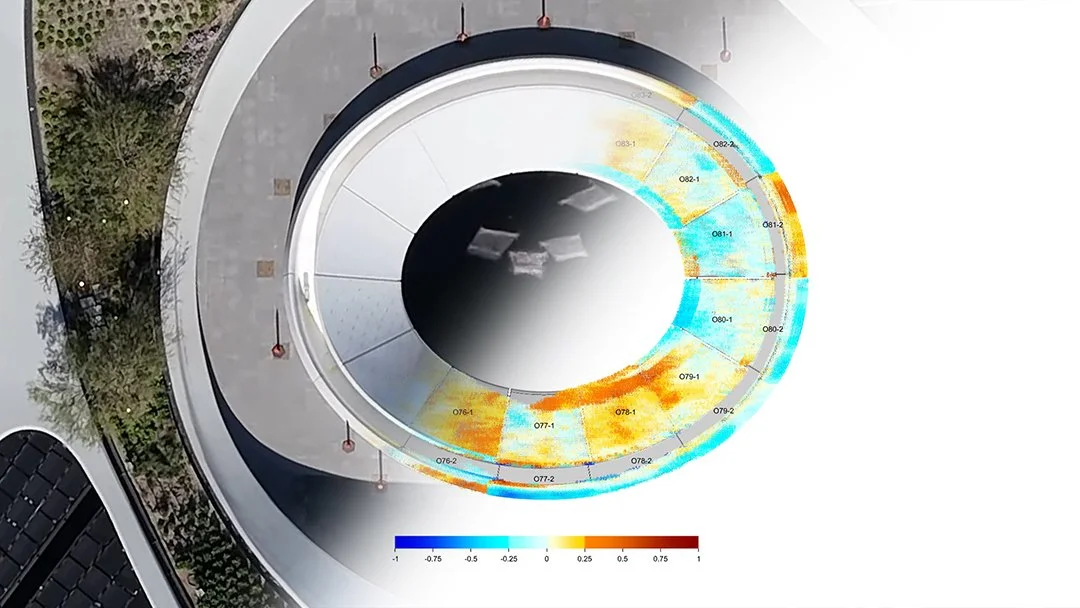
Custom Survey Jigs, As-Built Analysis, Point Cloud Analysis, Site Control, Temperature Studies, Movement Studies, Best Fitting, Layout, Target Points. Deviation mapping for decision making.
QA/QC
Protocol Documentation, Non-Conformance Reporting, Issue Tracking, Observation and Progress Reports, Onsite Resolution Support
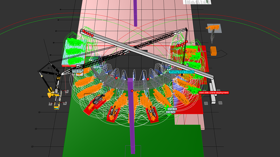
Installation Support
Strategy, Layout, Construction Jigs, Reference Models, AR/VR, Field Support, Logistics, Equipment Planning, Shoring Coordination, 4D Timeliners, Sequencing, Dynamic Rescheduling
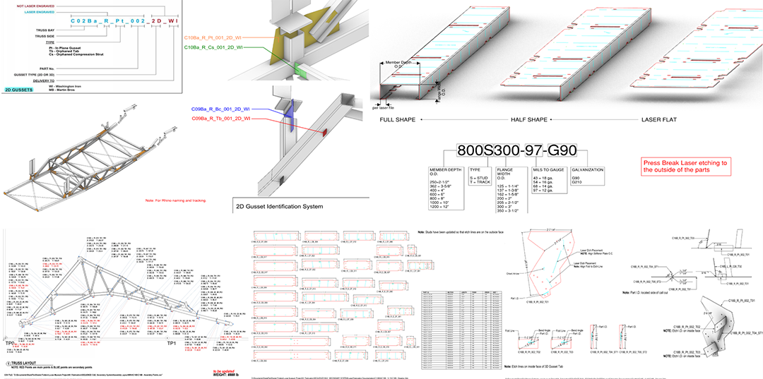
Model to Pre-Fabrication
Engineering Details, Shop Drawings, Assembly Drawings, Part Drawings, Construction Jigs, Full-Scale Templates, Laser and CNC CAD files, CNC and 3D Printing Models
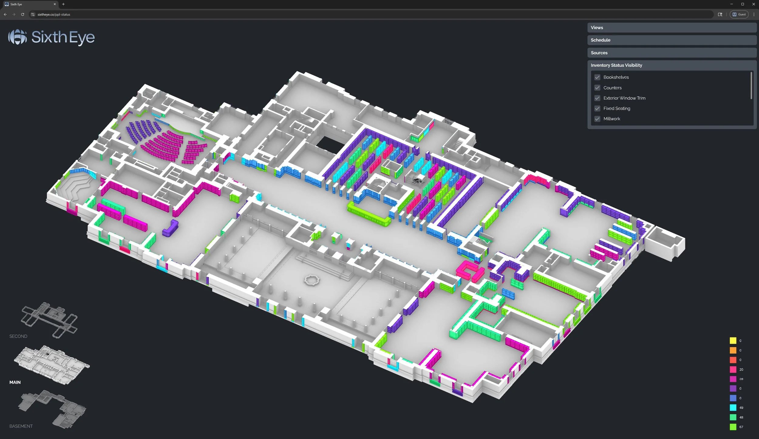
Spatial Project
Management Tracker
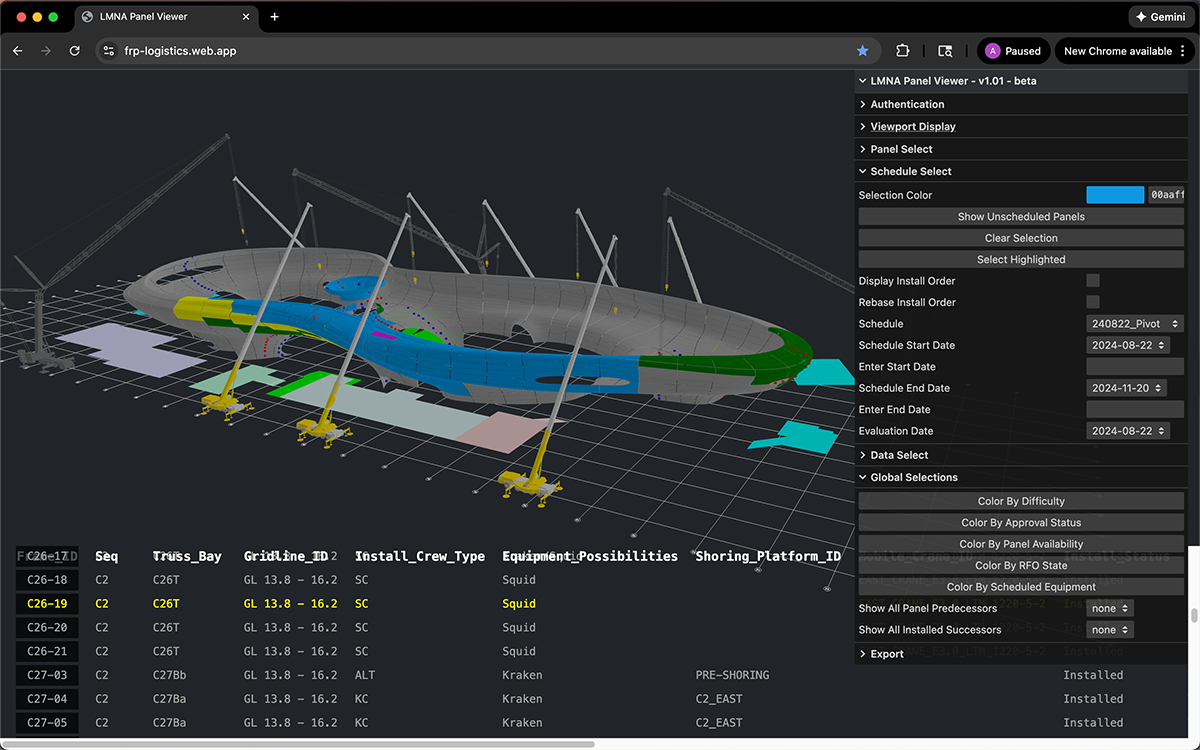
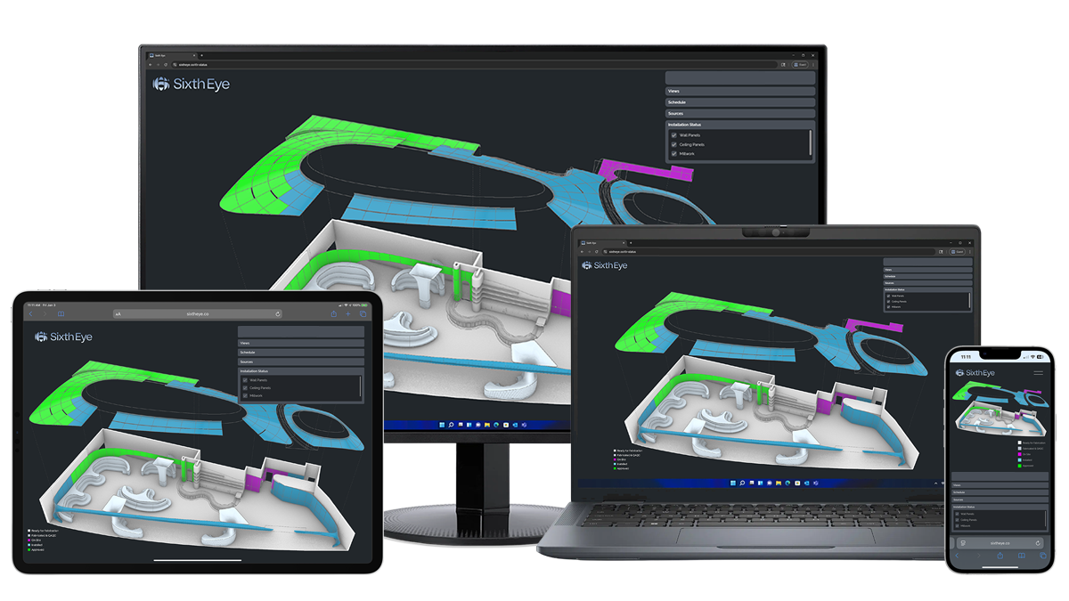
The Spatial Project Management Tracker unifies structured project data in a live, synchronized 3D environment across devices, enabling collaboration and a shared understanding across critical scopes.
Manufacturing progress, delivery logistics, installation milestones, approvals, and schedule data are anchored to a coordinated spatial environment, enabling stakeholders to review, align, and act in real time as the project progresses and evolves.
Applied selectively to high-impact scopes, the Tracker delivers focused visibility where budget, schedule, and performance matter most. Operating within our Digital Project Delivery Framework, it transforms distributed data into a collaborative spatial lens for informed, aligned decision making.
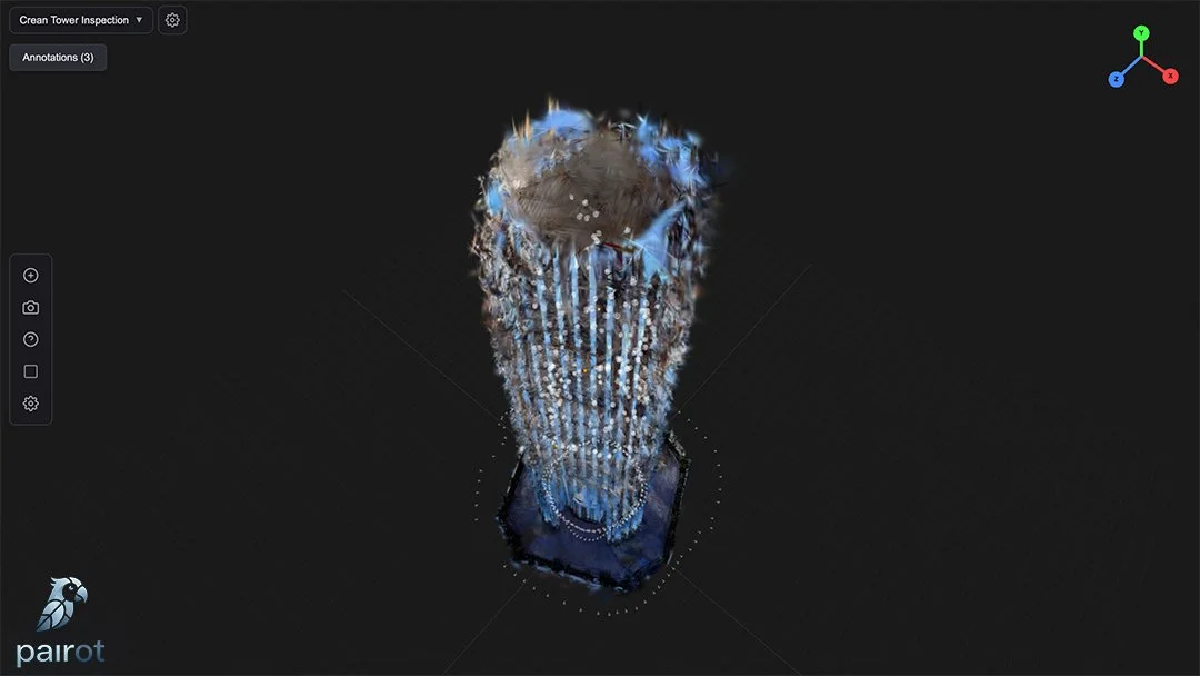
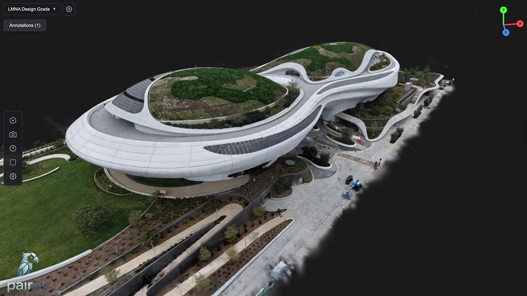
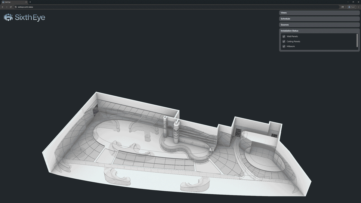
Pairot
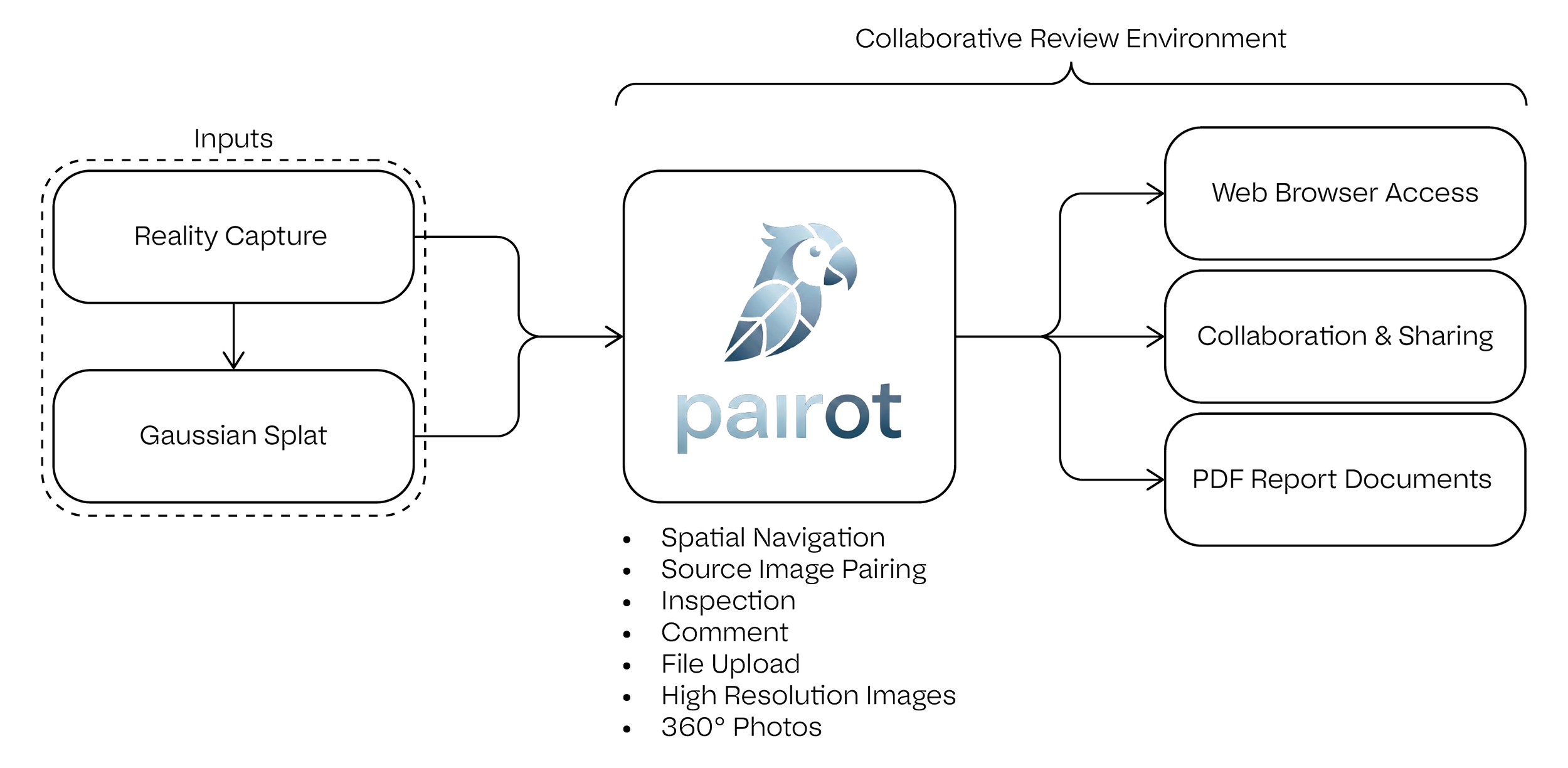
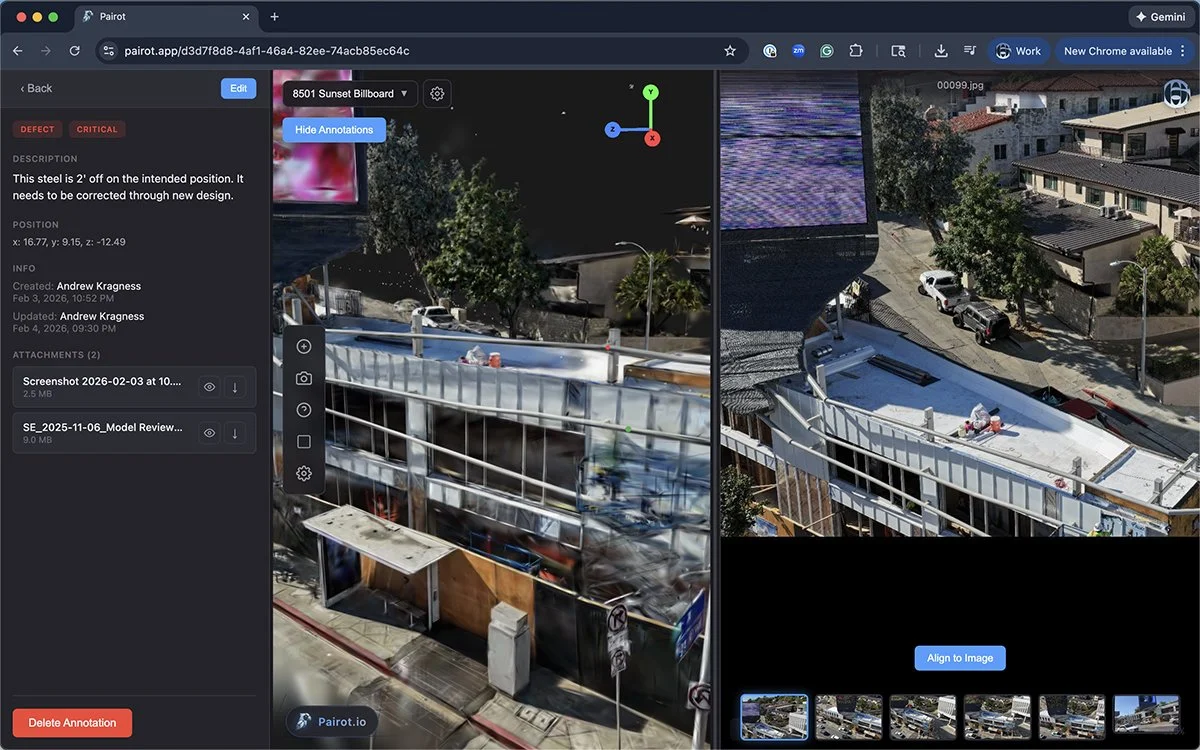
Pairot.app was developed through real project execution to create structured visibility across distributed teams working within dynamic field conditions.
It captures high-resolution site conditions and anchors them within a spatially navigable project environment on the web, allowing stakeholders to review, annotate, and collaborate directly within real as-is context.
Observations remain geolocated and traceable, enabling design-grade review, structured issue tracking, and informed decision-making across complex scopes.
As part of our Digital Project Delivery Framework, Pairot extends structured coordination into the field, reinforcing alignment between digital intent and physical reality.